Funter Bay History: 1920s Cannery Postcards

February 25, 2015

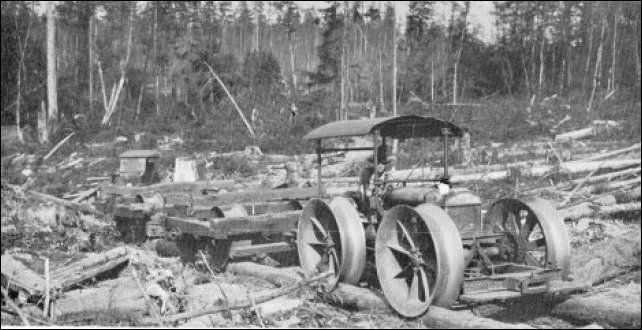
I recently came across a batch of postcards showing Funter Bay in the 1920s. These appear to have come from the estate of someone associated with the cannery. I was able to purchase several of these, and was generously given permission to use copies of the others here.

view1

It is not clear which of these were commercially-sold postcards and which were private photos printed on postcard stock. “Real Photo Post Cards“, or “RPPCs” enabled people to make a postcard from any photo. Kodak began offering pre-printed postcard stock early in the 1900s, and Federal law allowed postcards with written messages on the back in 1907. Some RPPCs were mass produced and some were unique prints by private individuals. Some of the cards in this set are labeled, dated, and/or have a photographers name, but most are unlabeled. Based on what I can identify of the people and vessels depicted, the dates range from around 1918 to the early 1920s.

The following map helps place some of these photos. This is part of the US Fish and Wildlife Service records from the National Archives, showing the cannery in 1942. The general layout is much the same as it was in the 1920s, with only minor changes. The 1929 Aerial photo that I previously posted is also helpful.

1942 Cannery map

Below is a colorized version of the first photo above. This view looks out over the cannery buildings from near the Native employees’ houses. The main wharf with long packing and warehouse buildings are seen, along with the twin chimneys of the boiler house. Bunkhouses and residences are in the foreground, with the mess hall and company store near the middle.

view4

The next photo shows an open area behind the mess hall and bunkhouses. Boardwalks lead between buildings, with what appear to be vegetable gardens on either side. Stacks of firewood are seen along the boardwalk, with long logs split into quarters. Clothes are hung to dry on the left of the nearest boardwalk, the laundry and bath house was located just off-camera to the left. The building on the far right is probably the repair shop which still stands today, behind it is the Superintendent’s house and just to the left of it are homes for managers and guests (one of these has also been referred to as a schoolhouse).

gardens

Below is a photo of the summer housing for Tlingit cannery workers. This is sometimes referred to as a village, although other accounts state that it was not occupied year-round. These structures were later demolished to make way for saltery buildings. Several canoes and a motor launch are visible.

village

A more distant view of the “village” shows its relationship to the cannery buildings (at left):

village2

A smaller photo or print shows a boat at the cannery’s floating dock, with Mt. Robert Barron in the background. This seems to have been taken from near the bunkhouse which sat partly over the high tide line:

boat

Two more photos show the floating dock from the other direction, taken at different stages of the tide with different small boats at the dock. A sign on the approach ramp appears to read “Private Float, no gas boats allowed”. The bottom photo shows scows with rolls of netting or fencing in the front, likely fish trap materials. Some of the boats seen in prior photos are moored to pilings in the background:

float float2

The next photo shows a higher angle view of the float approach and bunkhouse, maybe from the mast of a ship. The cannery’s wooden water tank is visible in the background. The cleared area between the tank and buildings would later hold the Chinese and Filipino bunkhouses. The company store is on the left. An interesting feature is the narrow ramp extending from the rear of the store into the water. This was the cannery’s trash chute where garbage was dumped into the bay. The base of this chute was very popular for bottle hunting at low tide in later years!

store

The next photo shows the rear of one of the waterfront buildings. A scow is moored to a piling in the middle ground, with the mountain shrouded in clouds behind. This may be from 1919:

view2

The next image also looks out over the cannery buildings, Mt. Robert Barron is in the background:

overview

And finally, a view out over Funter Bay to the South, showing Station Island (two sections, one forested), Rat Island, and Bare Island (low rock at left). Clear Point is on the right, and Chichagof Island’s mountains are visible in the distance:

water1


Funter Bay History: Census Takers and Logging Camps

February 4, 2015

Related to an an earlier post about population and census-taking, the following excerpt comes from the account of one Joseph Hewitt, census-taker for part of Northern Southeast Alaska in 1909-1910. Hewitt’s diary “Forty One Days of Census Taking in Southeast Alaska” describes his travels to “all the towns, camps, ranches and settlements located on Chatham Strait, Icy Strait and all their bays and inlets”. He traveled by gasoline launch chartered by the government and operated by its owner, B.F. Dennison, and Dennison’s 11 year old son Dewey. The census enumeration was performed in winter to ensure transient native populations would be in their home villages. Larger communities with schools were expected to provide a census via the local teacher, with people like Hewitt filling in the details for smaller outlying settlements like Funter Bay.

The full document is available here, both in original written form and typed transcription.

“The next day I enumerated twelve at Funter Bay. This is the site of the “Klinket Cannery”. This is a large establishment and it was their logging camp we found in Kelp Bay. We came into Funter Bay on Friday Jan 7th and had the delectable experience of being bottled up by a storm for six days. In shifting the boat one dark night from one part of the bay to another, a thing we frequently had to do to escape destruction during that siege, we lost one of our anchors overboard. The wind and waves seemed bent on driving us out of that bay. The storm outside was so fierce as to tie up the big steamers. Inside it was playing “puss in the corner” with us, and every time it said scat we had to hike. Had it not been for a small island and an unused steamer that was anchored out I don’t see how we could have escaped being driven on the rocks. On Monday morning we made an attempt to escape but were very glad to come back in and fight it out where the trouble started . Finally on Wednesday morning we got away.”

The description of Kelp Bay earlier in the manuscript reports a logging camp abandoned before the first snow, along with a few hundred new cut piles (pilings for dock and fish trap construction). Kelp Bay is on the NE side of Baranof Island, across from the southern end of Admiralty Island about 65 miles from Funter Bay. Although Hewitt reports the logging camp deserted, he did find around 15 people in the Kelp Bay area. A Tlingit family is listed in the 1910 census as associated with the Kelp Bay logging camp, including James Hanson, employed as a woodcutter, and his wife Mary. The court case between Funter canneryman James Barron and rival Claire Alexander (discussed in this post) also mentions Thlinket Packing Co superintendent Fred Barker towing logs from Kelp Bay to Funter for use at the cannery. The cannery tenders Buster and Anna Barron were used to tow rafts of trap piles.

It may seem strange that the T.P. Co would harvest timber so far from the cannery, but a possible explanation lies in the geography of Kelp Bay. Not only is it protected from storms, the bay offers very steep hillsides along the shore, an ideal place for gravity-assisted hand logging. The best trees could be selected and cut so as to slide into the water below. Around Funter Bay, most of the near-shore land is flat, and would require logs to be hauled by equipment or animals. (Limited near-shore logging did happen at Funter, as discussed here). Kelp Bay continued to be logged and clearcut into the 1990s.


Funter Bay History: Logging

May 23, 2013

While Northern Admiralty Island was never clearcut on an industrial scale the way the central section was, there have been occasional timber harvests in the Funter Bay area. Industrial logging was both helped and hindered by regulatory issues; creation of the Tongass National Forest in 1907 added some forest protections, but the Forest Service also earmarked large parts of National Forest to become foreign pulp exports. Private landowners had a few more options for local-use and some export harvests. General information and statistics on Alaskan logging is available here and here. A basic timeline of logging and timber regulation in Southeast Alaska in the 20th century is available here.

Handlogging tools at Funter Bay:
IMG_2159

Early hand-logging operations in the 19th and early 20th century supplied logs for fish traps and pilings, shipping crates for canned salmon, wood for cannery and mine construction, and possibly fuel (although coal was more common as a fuel for steam boilers, possibly due to the high sap content of local spruce adversely affecting machinery). Most hand-logging operations were based from boats, the loggers would cut trees very close to the shoreline where they would fall into the water, then they would be tied into rafts and towed to lumber mills at Juneau and Douglas. Today there would not be much evidence of this forest-edge harvesting, but the practice probably explains why photos from the early 20th century show very few trees on the small islands in Funter Bay. These islands are heavily re-forested today, they would have been convenient places to cut old-growth spruce and float it away.

station

Despite the abundance of timber, some businesses imported lumber for construction, including the Funter Bay cannery (which brought in California Redwood beams), and other local buildings which were pre-fabricated and shipped up as packages. Certain woods like pine, and especially redwood, are more rot-resistant than the local spruce, and buildings made out of such woods have lasted longer in the damp environment. Spruce pilings driven near the shore or used as building footings were often soaked in tar to make them last longer.

Part of a shipping address stamped on lumber brought in from down south in the early 20th century:
OLYMPUS DIGITAL CAMERA

Barry Roderick’s “Preliminary History of Admiralty Island” mentions a single cable-logging operation on the island in 1905 (where logs would be hooked to a cable and pulled or zip-lined to the beach). Later operations would have been more mechanized, with tractors and engines used to haul logs from stands of timber deeper in the woods. Of special interest were the old-growth cedar trees, prized for their rot resistance.

In 1911, the US Forest Service decided that clearcutting (AKA “Clean Cutting”) was the best method, supposedly it would allow sunlight to reach the forest floor and make new trees grow faster (in reality, clearcutting just creates big jungles of berry bushes, destroys wildlife habitat, and leaves the soil unprotected to wash away into salmon streams).

Sawmill equipment was delivered to Funter Bay in 1918 by the steamer Admiral Goodrich, probably for one of the mines. A 40hp steam-powered sawmill was reported in 1920.

In 1922 the Alaska Gastineau mine in Juneau purchased timber rights on Admiralty Island, but the sale was cancelled due to financing issues.

logging

After WWII, the Forest Service attempted to entice pulp mill operations to Southeast Alaska. There were also some attempts to cut spruce for plywood and export full logs overseas, but most development seems to be devoted to grinding up the trees for pulp. These operations were heavily subsidized by the government, and still claimed to be operating at a loss. Local rumor has it that Japanese investors are stockpiling logs to sell back to the US once we’ve clearcut everything.

The Keelers who had a cabin near Clear Point (and possibly one at Hawk Inlet?) did some logging. The uncle-nephew team purchased a large two-man chainsaw. Unfortunately, the younger man was killed when one of the first trees they cut tree fell on him.

In the 1960s, local resident Ray Martin had a plan to log old-growth cedar from between the creeks at Crab Cove. His idea involved building a railroad from a dock at “The Point” up to the old-growth cedar stands between the creeks. The cedars would have been used for telephone poles. Ray apparently had many “get rich” schemes that never took off, and the logging operation was no different. He eventually landed in some legal trouble due to a shady stock deal with a company in Juneau.

The biggest logging project at Funter Bay was run by the Alaska Dano Mining Co in conjunction with Gary Lumber Co of Juneau. Spruce (and some Hemlock) was harvested from approximately 30-35 acres on and near Dano’s mining claims around 1969. Sources indicate that it was around 1.8 million board feet, mainly for export.  In 1971, the US BLM transferred 33 acres to the state in the section which was logged, this could have been related to Dano’s operation, but I am not sure.  The clearing resulting from Dano’s logging is still visible in satellite imagery, although its a much smaller scar than those left by the bigger industrial logging operations elsewhere on Admiralty Island.

Dano clearcut and logging road, 10 years after the timber harvest (color infrared image showing different vegetation types):
clearcut

A Forest Service memo notes a timber sale of 222mbf (million board feet) in the Funter Bay area in 1969. That volume of timber would indicate an area of roughly 500 acres, much larger than the Dano clearcut. The appraisal price was 3 times higher than the average for Southeast Alaska, which could mean that cedar was the target rather than spruce. This could be related to Ray Martin’s plan, or to a late-60s plan to bring a large pulp mill to Juneau and clearcut the surrounding forests.

Today there are the remains of a piledriver at The Point, but I am not sure if this is specifically related to Ray Martin’s logging scheme, or simply left over from something else.

The other remains of Ray’s logging scheme include a mobile logging arch left on his property (which became our home). When my parents expanded our house, the arch was too heavy to move, so Dad incorporated it into the foundation of the deck!

OLYMPUS DIGITAL CAMERA OLYMPUS DIGITAL CAMERA

A logging arch would be used in conjunction with a tractor, to raise one end of a log and then drag it somewhere for loading. Here’s a model of one. Here is a page showing logging arches in use. Here is a photo of a logging arch being used to assemble a log raft on an Alaskan beach.

Dad believes this was Ray’s tractor, a Fordson made by the Ford Motor Company in Detroit:

OLYMPUS DIGITAL CAMERA

OLYMPUS DIGITAL CAMERA OLYMPUS DIGITAL CAMERA OLYMPUS DIGITAL CAMERA

Fordson tractors were quite popular in Alaska. It also seems to have been somewhat common to turn them into small railway locomotives, everywhere from Nome to New Zealand.

Here’s a Fordson-based locomotive in Nome, AK:
Nome Alaska, Iron

Here’s the low-budget model, with the rail made of logs (a “pole road”) and the wheels apparently just big flanged rims. And here’s a whole bunch more. A salt mining company once built a monorail using Fordson tractor motors!

Here is a mention of another small railroad in Southeast Alaska, with a Fordson locomotive. That site also had a Fordson-powered sawmill:
fordson

Ray Martin had a marine railway at the property, which included some tracks leading from the beach up to the house, and some wheels and axles. This would have been used to haul his boat out for storage and repairs, but maybe he planned to build his own logging railroad using some of this equipment as a starting point? By the 1950s, mines in Southeast Alaska were switching from railways and tramways to gravel roads, and surplus rail equipment would probably have been available cheaply.